Showing posts with label hiking in Virginia. Show all posts

Monday, April 9, 2012

Tar Jacket Ridge- George Washington National Forest

In an effort to keep the adventure buzz humming for spring break we loaded up the truck and headed to Amherst County and the GeorgeWashington National Forest for a weekend backpacking trip.

We have made Easter weekend a traditional jump off point for trips because of the elongated break it afforded us and this trip was no different in that it was designed around the idea of “getting away” from the hustle and bustle of normal work related stressors with the exception that this time our trip would have to be abbreviated due to prior work related responsibilities on my end. 

That being said, Ash had pre-planned and scouted a 15 mile “lollipop” route known as the “Tar Jacket Ridge” loop which is across the way from Mount Pleasant where we had previously backpacked in 2009.
The route map has specific detailed information about the hike & points of interest
~ Thanks Ash~
So once the logistics of packing and food prep were done in between work schedules, we were on our way.
Ramsey shows her enthusiasm for the hike  
The beginning of the hike starts off mellow enough in a vast green meadow at the foot of the first real climb just off of the forest road that you park on.  
Several primitive campsites dot the area and are readily accessible to car camping and backpackers alike with the Appalachian Trail meandering through the open field.
It didn’t take us log to be reminded that we were backpacking in the mountains as a short climb opened up to a panoramic view of the surrounding peaks; Mount Pleasant, Cardinal, Friar, and Little Friar to name a few.    

The trail then snaked it’s way back down hill switch backing into the forest and across one of several forest development/ fire roads that we would crisscross along the way.
This particular section was a mix of large rocks & boulders interspersed with thickets of thorns, so we identified few camp sites along the way.


The trail then opened up into large areas of mixed hardwoods and pine forests with little to no underbrush again with limited sites for camping because of the significant pitch of the land.
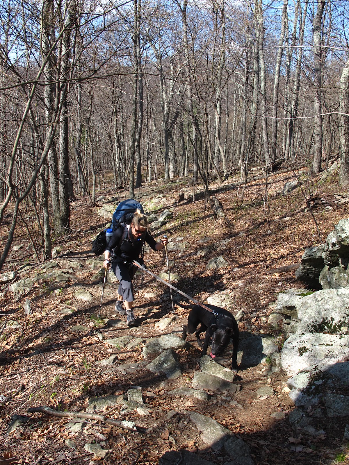
After 6 miles of steady hiking we came across a beautiful camp site nestled between two small creeks.


The site had a small fire ring in a flat area adjacent to a massive rock with a huge decayed tree growing from it making for a prominent focal point. 

A few hours later we were drinking Horton Eclipse red wine near a crackling camp fire as the sun slowly dipped behind the wooded hills.


The forecast called for seasonable temps and clear skies with a pronounced dip in the mercury at night, and I would suspect that it got into the 30’s but as anyone who has backpacked can attest to; the answer to the most common question of; “How can you stand to be out there in the cold”, is explained by the fact that a two person tent when paired with quality down sleeping bags can create a rather pleasant interior environment of 50 to 60 degrees for world class sleeping arrangements( sans the fact that our two pups haven’t quite grown accustomed to sleeping outside with  the cacophony of unusual sounds that go along with the backcountry in the stillness of the night).    

Once the dogs settled in our K-9 wrestle-fest turned into snoozing and we “slept in” to allow the morning chill to subside.
After several cups of Starbucks instant coffee packs (backpacking godsend) and some filtered water from the stream we were on our way towards the “Seeley Woodworth” shelter and our turn around point to head back.
Up one ridge and down the other we went, on & on through the woods.


We covered 6 miles on the first day and decided to press on for the second covering just over 9 miles to complete the circuit.   
Solitude abounded on this hike, granted we saw several backpackers and hikers along the way, but we would go for hours at a time without crossing into another human’s path.   
The jingling of the dog’s leashes kept wildlife at bay as we saw limited animals on our trek; although we did receive a serenade by what we believe was a winter wren at our campsite by the boulder & stream.       
To get away, to get in your car and just go, to make a plan and stick to that plan, to put perceived obligations on the shelf if only for a while, to go somewhere that manages to transport you even further, to places that make you feel further away than you actual are, the search continues…  


 Stephen

Monday, April 2, 2012

Jones Run Trail- Shenandoah National Park

My extended 40th B-day celebration continued this weekend with Saturday seeing us at several local Craft breweries; Hardywood Park & Legend Brewery and a day hike in Shenandoah National Park on Sunday.


The fog rolling across Afton Mountain slowed our progress but did not dampen our spirits as we were both excited about another adventure in "SNP", which you may recall we have had limited exposure to as we have opted to explore further locals in the past.

Our Route
We weren’t on the trail long before we had disappeared into the forest under a blanket of thick fog, and light rain, and I couldn’t help but think that any vistas would be shrouded in low lying clouds.
Ash being a keen observer assured me that Jones Run trail was not known for its scenic views of the mountains but for another enticing attribute, its waterfalls.

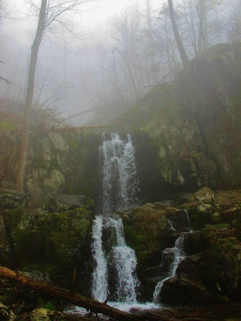
And Jones Run did not disappoint with one waterfall after another cascading down the mountain with thundering noise and constant concussion from the impact of the falls.


We spent around 4 hours on the hike taking our time and treating it as more of a getaway trek than a fitness hike.

I would classify the hike as moderate to easy depending on your fitness level with a brief climb that you could definitely feel.  
There are few (We saw one) camp/backpacking sites along the hike, but numerous swimming holes along the route that would be ideal for warmer days. Some reviews indicate that the trail becomes considerably overgrown with nettles in the warmer months but it was incredibly clear and well marked while we were there. 
We passed several groups of like minded folks with one large group of around 12 or so hikers traveling in the opposite direction.

Curiously one family who had obviously taken a short spur trail from one of the many parking areas off of Skyline Drive were not fans of our leashed dogs as the mother of the group went squealing off into the wood line as we passed them on a short uphill section. Really? (I will avoid any further commentary on the subject)…   
   
Jones Run winds back and forth across Skyline Drive with a short sampling of the Appalachian Trail, so should you be in the mood for solitude you may want to consider another hike as the last quarter of the trail runs along the road and its accompanying traffic a fact that had very little impact on the experience for us.    
It’s incredible that places like this still exists, places that are as old as time itself and remind us of just how insignificant we really are.


Grilled Buffalo wings in a Sriracha-honey glaze with an Anderson Valley "Boont" Amber Ale for post hike grub, perfect.

Stephen


Wednesday, July 20, 2011

Rip Rap Hollow Trail - Shenandoah National Park

                      
Ash and I have been kicking around the idea of taking our local trail runs/hikes to higher elevations and distances for some time now, but a myriad of injuries, scheduling issues, and far sightedness have been speed bumps on our road to trail running/fast packing progress.

So how does far sightedness factor into trail running and hiking?

We have been all over the Blue Ridge Mountains but have concentrated our energy on the “far flung” areas of The Blue Ridge Highlands, like Pulaski and Grayson Counties.

That “farsightedness” has caused us to overlook some prime trails in our own back yard.

It turns out that the entrance to Shenandoah National Park is almost exactly an hour from our home, who knew?

Adding to this close proximity is the fact that Ash, being the master strategist that she is, has been plotting day hikes close enough to the homestead so that we could spend the day exploring and still be back in time to grill out, drink a few beers, and relax.

Truth be told, we have been to Shenandoah National Park in the past but my aversion to paying money for access to the wilderness had kept me away from the idea of going back.

A robust $15.00 entrance fee didn’t help the cause.

Well, the entrance fees aren’t going to change, and I love the idea of finding new places to go, so I decided to change my perspective.

For $30.00 bucks you can buy a year’s pass to the park, go twice and it’s paid for, to get your money’s worth you should go as often as possible, so the park fee actually encourages you to get out and see more of the outdoors!

You have to love that reasoning.

Ash set it up, a hiking/fast packing loop under 14 miles that had great views, a flowing creek, and incorporated a section of the venerable Appalachian Trail.

Sunday morning found us at mile 90 of The Skyline Drive and the parking lot for Rip Rap Hollow trail. (Several vehicles were already on site, but with ample parking still available).

The trail, (which we hiked in a counterclockwise direction) is a 9.5 mile circuit rated as “moderately strenuous” that ties together Rip Rap Hollow, the AT, and a 2.62 mile climb up Wild Cat Ridge, then back to the AT and the parking lot to complete the loop.

Our Route
The trail has an elevation gain of 2200 feet and can be done as a day hike or an overnight backpacking trip.

Depending on where you look, the hike can take anywhere from 5 to 8 hours to complete.

That being said, Ash, our two pups and me moved at a good clip and completed the circuit is just under 4 hours with stops for lunch, and exploring.

I counted around 5 well placed campsites along the trail that would comfortably fit the average 2 person tent.

The best overlooks/views included Calvary Rocks, and Chimney rock which did not disappoint as we were treated to some incredible cloud formations moving across the bright green landscapes of distant mountains.

The view from Calvary Rock
Chimney Rock overlook
Another perk to hitting the trail in July were the abundance of wild blue berries, and the occasional blackberry bush, with fruit that was incredibly sweet.

trailside Blueberries


One of the key attractions of the trail is a brilliant swimming hole just down stream from a 20 foot waterfall.

The swimming hole had the highest concentration of trail users so in my normal fashion we “kept on keeping on” to put some distance between us and them.


Based on Ash’s trail notes and topo map we sat down at a campsite just off of the stream to fuel up before the charge up Wildcat Ridge.

After the 2 mile scramble we took a breather at the intersection with the AT and then cruised for 2 more miles back to the car.


Rip Rap Hollow has just about everything you could want in a hike, Panoramic views, an awesome stream that dumps into an incredible swimming hole, and various forms of flora and fauna.

Our mindset for this trip was more about pushing ourselves and our individual physical capabilities than our backpacking trips which center on being surrounded with nature.

Each adventure takes on its own personality, and without saying a word we both knew that we wanted to test or mettle on longer distances and "wilder" terrain.

The problem with Bears...

So between sips of brown ale and crab cake quesadillas, I couldn’t help but grin at the thought that we had found yet another playground so close to home.